Bike Infrastructure in Austin, Texas
ArcGIS Pro · Cartographic Design
GIS Workshop for Planners (PUP 576), Spring 2026
A map of Austin's bike network, classified by facility type — bike lanes, buffered lanes, cycling tracks, and multi-use paths.
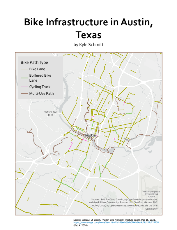
This map classifies Austin’s bicycle infrastructure by facility type to show how different levels of bike accommodation are distributed across the city, from painted lanes to physically separated cycling tracks.
Data source: Esri, TomTom, Garmin, and OpenStreetMap contributors, via ArcGIS Online.