GIS & spatial analysis work
A collection of mapping and spatial analysis projects from my graduate work in urban and environmental planning at ASU, built in ArcGIS Pro.

Grocery Inaccessibility in Sherman, Texas
ArcGIS Pro · Network Analysis · Suitability Analysis
A network and suitability analysis identifying areas of Sherman, TX with limited access to grocery stores.
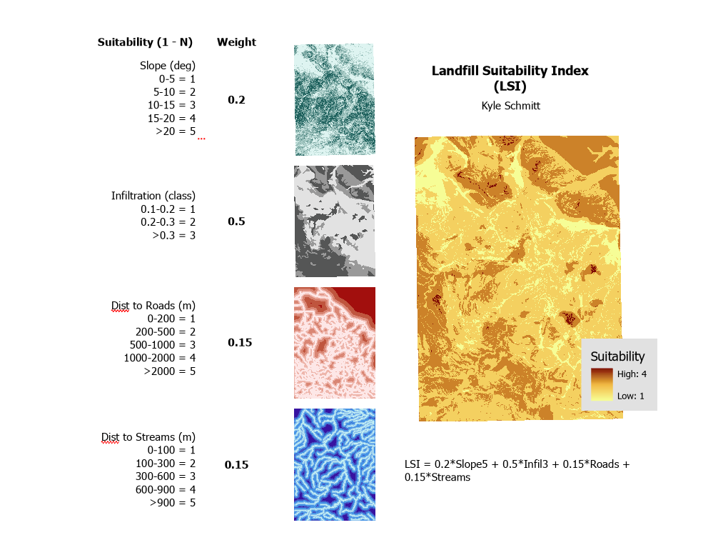
Landfill Suitability Index
ArcGIS Pro · Raster Analysis · Weighted Overlay
A weighted suitability model identifying optimal landfill sites based on slope, soil infiltration rate, and distance to roads and streams.
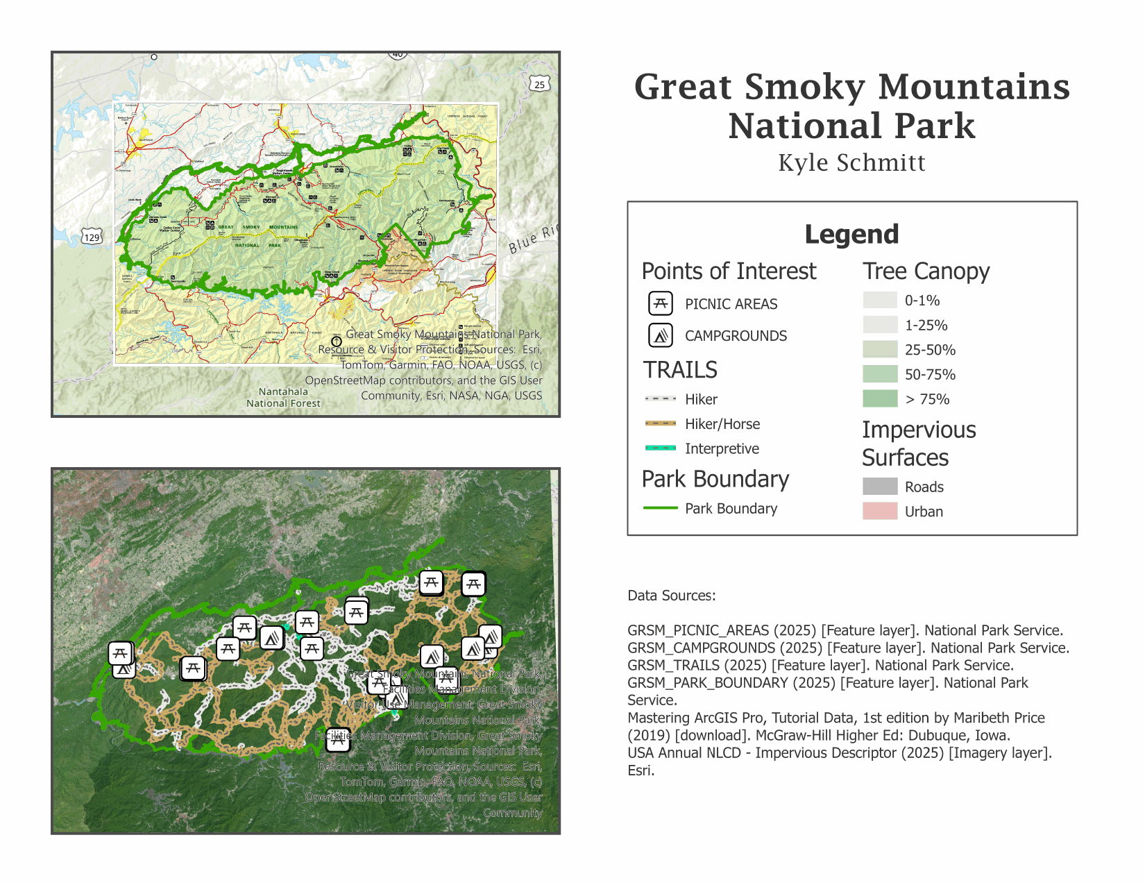
Great Smoky Mountains National Park: Recreation & Land Cover
ArcGIS Pro · Cartographic Design · Land Cover Analysis
A recreation and land cover map layout for Great Smoky Mountains National Park, combining trail and facility data with tree canopy and impervious surface analysis.
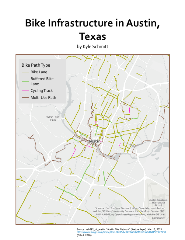
Bike Infrastructure in Austin, Texas
ArcGIS Pro · Cartographic Design
A map of Austin's bike network, classified by facility type — bike lanes, buffered lanes, cycling tracks, and multi-use paths.
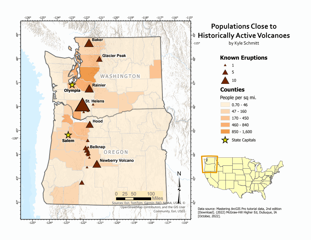
Populations Near Historically Active Volcanoes, Pacific Northwest
ArcGIS Pro · Cartographic Design · Demographic Analysis
A map identifying Washington and Oregon populations living near historically active volcanoes, symbolized by eruption frequency and county population density.