Landfill Suitability Index
ArcGIS Pro · Raster Analysis · Weighted Overlay
GIS Workshop for Planners (PUP 576), Spring 2026
A weighted suitability model identifying optimal landfill sites based on slope, soil infiltration rate, and distance to roads and streams.
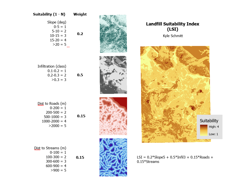
This analysis combines four weighted raster inputs — slope, soil infiltration class, distance to roads, and distance to streams — into a composite Landfill Suitability Index (LSI) highlighting the most viable locations for landfill siting while accounting for environmental and accessibility constraints.
LSI = 0.2 × Slope + 0.5 × Infiltration + 0.15 × Roads + 0.15 × Streams