Populations Near Historically Active Volcanoes, Pacific Northwest
ArcGIS Pro · Cartographic Design · Demographic Analysis
GIS Workshop for Planners (PUP 576), Spring 2026
A map identifying Washington and Oregon populations living near historically active volcanoes, symbolized by eruption frequency and county population density.
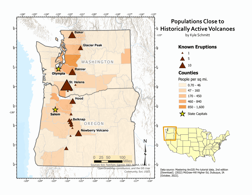
This map layers historically active volcanoes across Washington and Oregon — sized by known eruption count — against county-level population density, to visualize where population exposure to volcanic hazards is highest.
Data source: Mastering ArcGIS Pro tutorial data, 2nd edition (McGraw-Hill Higher Ed, 2022).