Great Smoky Mountains National Park: Recreation & Land Cover
ArcGIS Pro · Cartographic Design · Land Cover Analysis
GIS Workshop for Planners (PUP 576), Spring 2026
A recreation and land cover map layout for Great Smoky Mountains National Park, combining trail and facility data with tree canopy and impervious surface analysis.
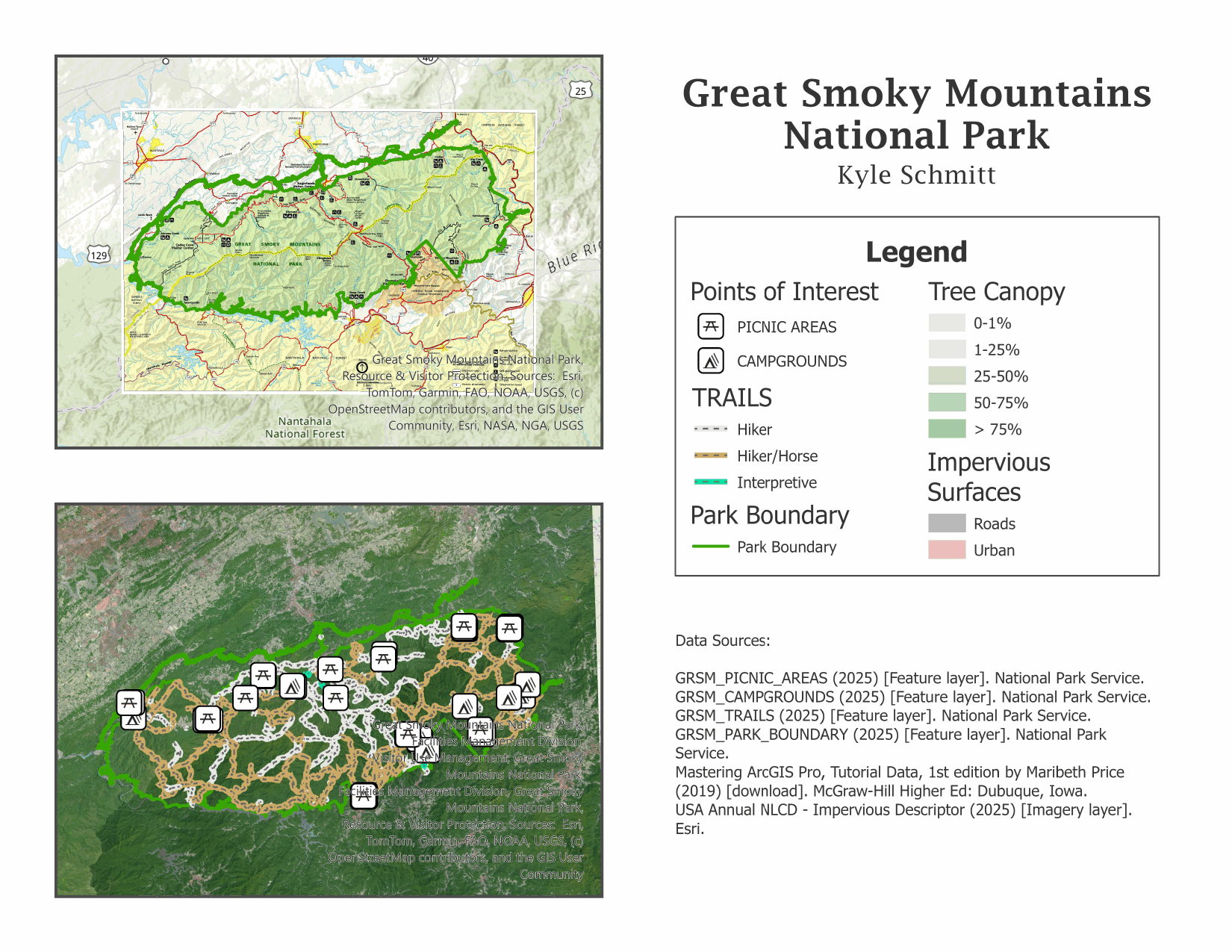
This map layout highlights recreation infrastructure — picnic areas, campgrounds, and trails — across Great Smoky Mountains National Park, layered against tree canopy percentage and impervious surface data to show how development and land cover interact with park facilities.
Data sourced from the National Park Service, Esri, and Maribeth Price’s Mastering ArcGIS Pro tutorial dataset.